
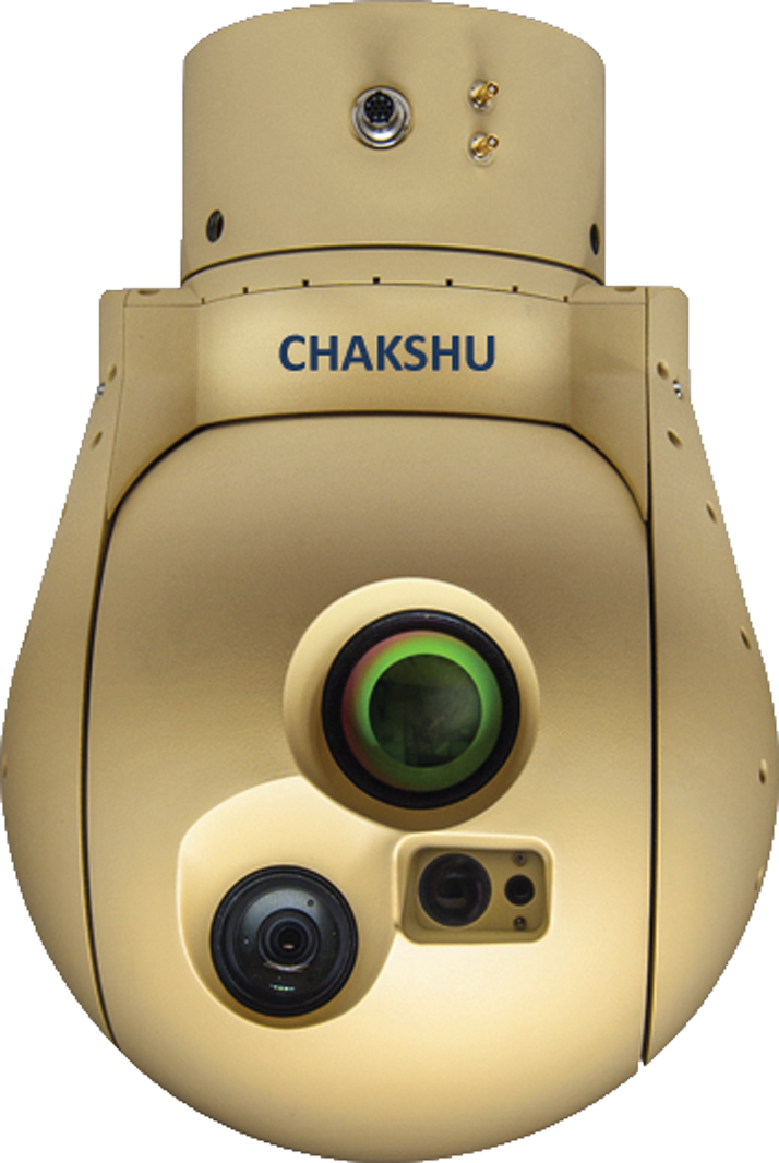
State-of-the-art high-quality image stabilization
Geo-reference, Geo-tracking & mapping software
Multi-sensor gimbals, configurable and customizable
Light weight compact equipment, low power requirement
Automatic detection & tracking of stable and mobile targets
Ease of use, easy integration and versatile
User-friendly Ground Control Station (GCS)
DGCA Compliant, BVLOS ready
Estimate target GPS coordinates Collision Prevention
HD/4K/EOIR Camera
1K near real time Video Transmission
Optional AI-based on-board Image processing
Customized Drone Solutions
Indigenously developed

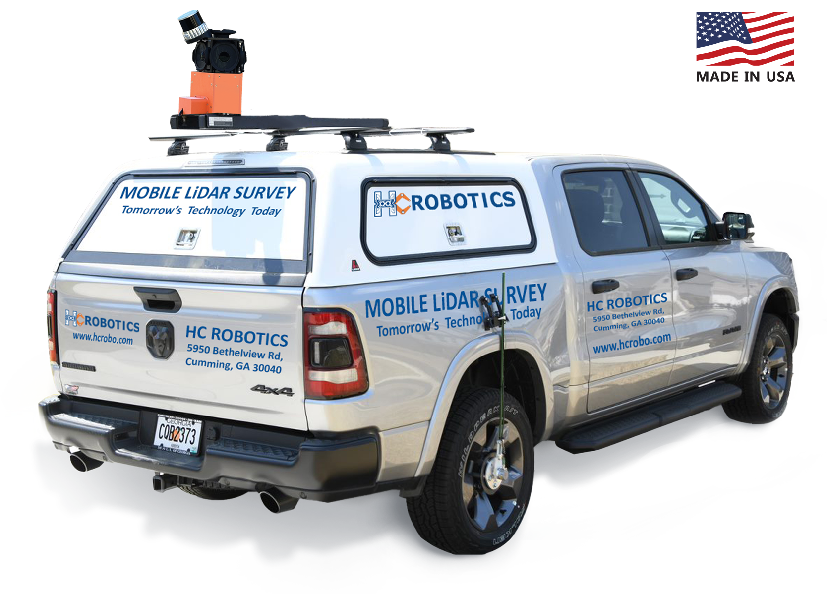
Road survey, corridor mapping, asset monitoring
72MP high-resolution images with up to 5.2M PPS
Application: Telecom, Utility, Railways, Smart Cities
Vegetation management and post-disaster management
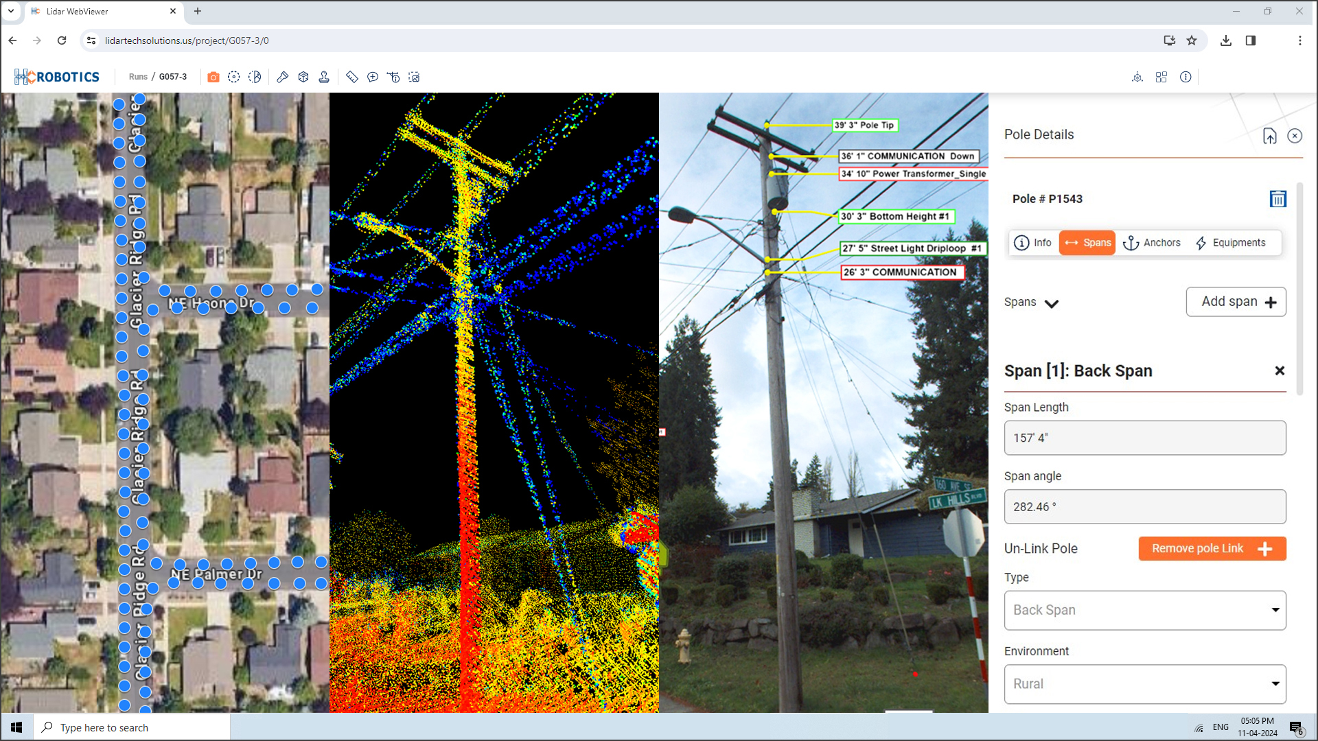
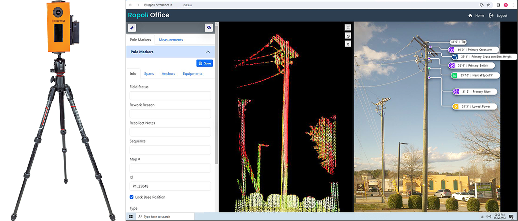
HC Robotics LiDAR Viewer enables users to interactively explore three-dimensional point cloud datasets captured by LiDAR sensors. Our LiDAR Viewer is a web application with 360 panoramic view and facilitates secure data access and transfer.
Accurately overlay point cloud data onto 72MP panoramic images
Callouts, highlights, cylindrical clip features
Specialized tools for pole data collection
Export to KML, JSON, and Shapefiles
Cloud and on-premise solutions
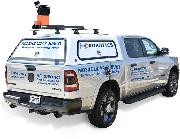
Portable LiDAR system
Lightening fast - capture LiDAR data in 3 secs
1M PPS dense point cloud data with 24MP image
GPS and digital compass ensure cm level accuracy
Perfect solution for back alleys, rear lots, sidewalks, urban areas
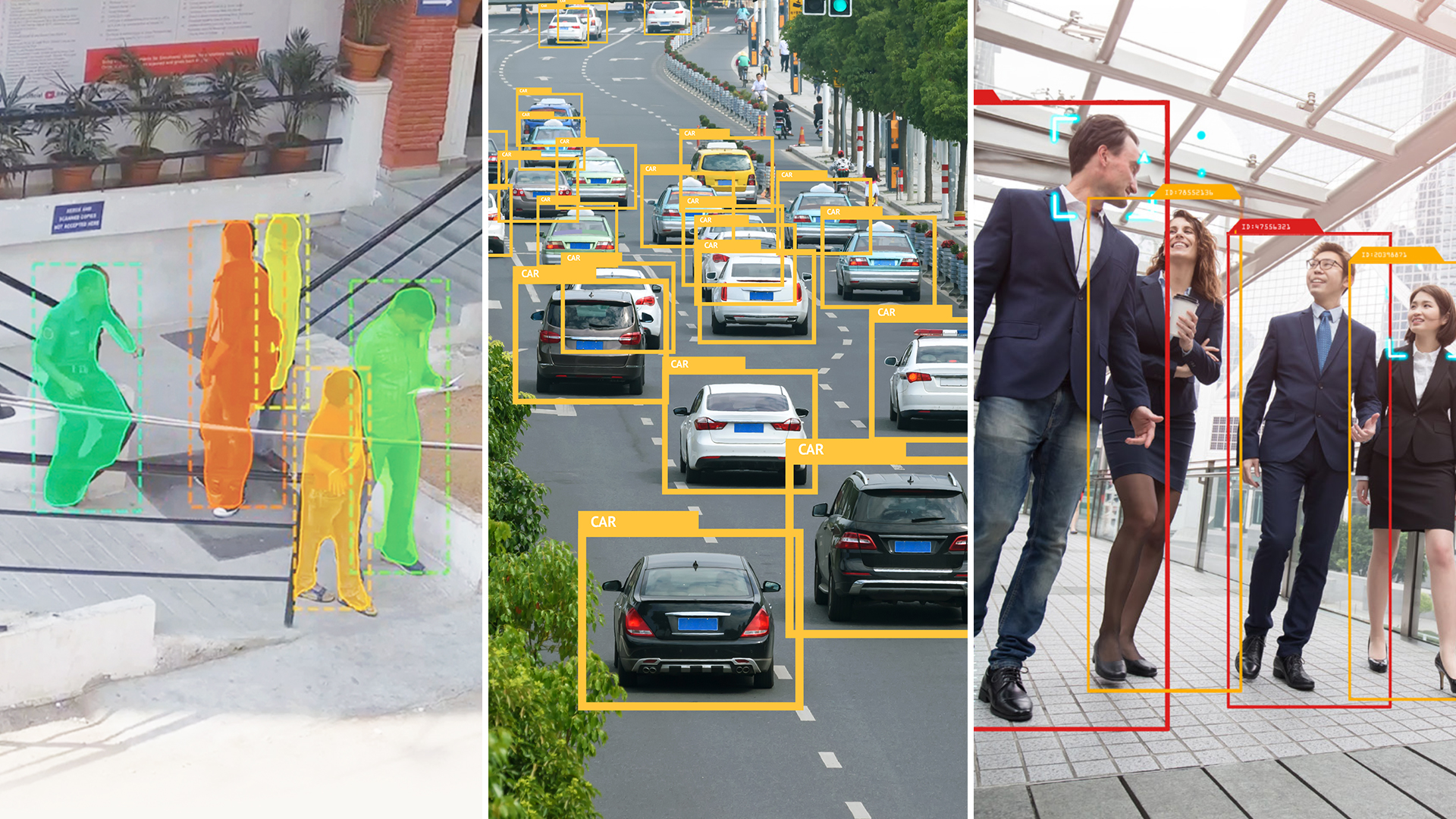
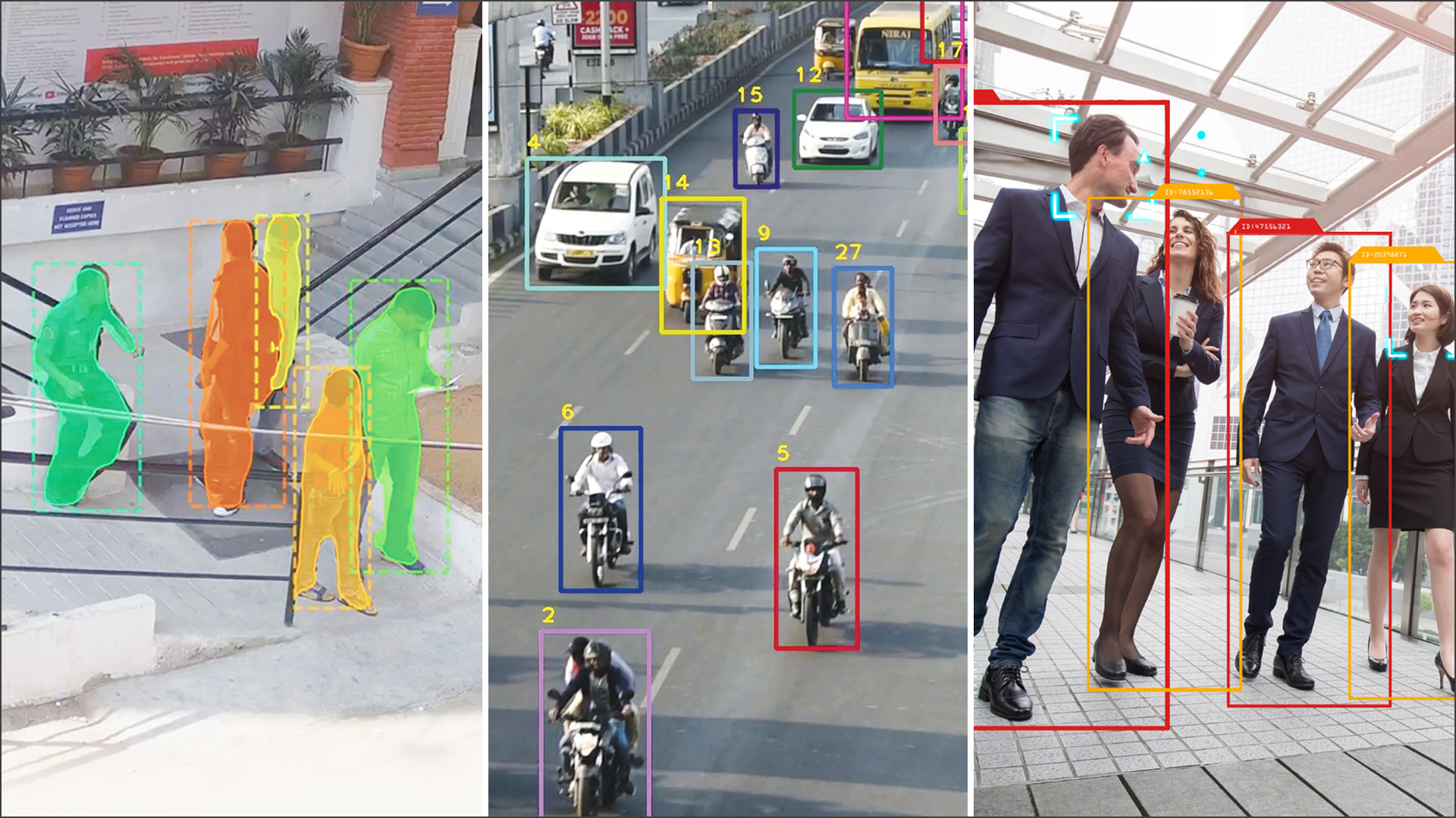
HC Robotics AI image processing technology involves the use of artificial intelligence to analyze, interpret, and manipulate digital images. Our AI image processing can perform object detection, image classification, segmentation, enhancement, and generation.
Person and vehicle detection – RGB & Infrared
Object tracking and activity recognition
Automatic Number Plate Recognition (ANPR)
Image deblurring & super-resolution
Image haze/noise removal
State-of-the-art high-quality image stabilization
Geo-reference, Geo-tracking & mapping software
Multi-sensor gimbals, configurable and customizable
Light weight compact equipment, low power requirement
Automatic detection & tracking of stable and mobile targets
Ease of use, easy integration and versatile
User-friendly Ground Control Station (GCS)
DGCA Compliant, BVLOS ready
Estimate target GPS coordinates Collision Prevention
HD/4K/EOIR Camera
1K near real time Video Transmission
Optional AI-based on-board Image processing
Customized Drone Solutions
Indigenously developed
Road survey, corridor mapping, asset monitoring
72MP highresolution images with up to 5.2M PPS
Application: Telecom, Utility, Railways, Smart Cities
Vegetation management and post-disaster management
HC Robotics LiDAR Viewer enables users to interactively explore three-dimensional point cloud datasets captured by LiDAR sensors. Our LiDAR Viewer is a web application with 360 panoramic view and facilitates secure data access and transfer.
Accurately overlay point cloud data onto 72MP panoramic images
Callouts, highlights, cylindrical clip features
Specialized tools for pole data collection
Export to KML, JSON, and Shapefiles
Cloud and on-premise solutions
Portable LiDAR system
Lightening fast - capture LiDAR data in 3 secs
1M PPS dense point cloud data with 24MP image
GPS and digital compass ensure cm level accuracy
Perfect solution for back alleys, rear lots, sidewalks, urban areas
HC Robotics AI image processing technology involves the use of artificial intelligence to analyze, interpret, and manipulate digital images. Our AI image processing can perform object detection, image classification, segmentation, enhancement, and generation.
Person and vehicle detection – RGB & Infrared
Object tracking and activity recognition
Automatic Number Plate Recognition (ANPR)
Image deblurring & super-resolution
Image haze/noise removal